
|
■Overview of Peru
|
Republic of Peru, commonly known as Peru, a nation having a republican
government located in a line of latitude about 18 degrees to the south
of the equator of western South America. The north part borders Colombia,the
northwest part borders Ecuador, the east part borders Brazil, the southeast
part borders Bolivia and the west part is on the Pacific Ocean. From dry
desert with little rainfall, to Andes highlands of 6,000m above sea level
and Jungle land of Amazon Basin, varied natural features and climate are
in this country. 60% of the nation is tropical rain forest area of Amazon,
and the Amazon river whose basin area is the number one in the world runs
through Brazil from Peru, flows down to the Atlantic. Much ancient civilization
prospered from B.C. and were a center of Inca Empire (Tawantin Suyu) which
was the largest empire at that time until the 16th century. After the colonial
period, it was independent from Spain in 1821. After it experienced many
internal disturbances including the Peruvian revolution and military regime,
came into democratic government in 1980 and has current political system.
Peruvian GDP of 2010 was 153,400 million dollars (approximately 12 trillion
yen), main industries are in the mining industries such as copper, lead,
zinc, silver and gold, also marine products industry thrives. Now the economic
growth rate of Peru is top-class of South America, it comes into the limelight
of the world as a promising rising nation.
|
See on the large map |
- Total area of Peru : Approximately 1,280,000 km² (approximately 3.4 times
of Japan)
- Total population of Peru : Approximately 30 million
- Population of capital Lima : Approximately 8 million
|
|
■Present Situation of Water
|
As for water in Peru, the situation varies according to each area. The
conditions differs completely for a variety of geographical features in
the east and the west of the Andes of 6,000m above sea level. In the east
side, the precipitation is abundant in the source area of Amazon because
it is jungle area. However it hardly rains in the western desert area.
Cities where majority of people live including capital Lima are in the
western desert area of the Andes. The shore desert zone of 30-50 km in
width and 3,000 km in length facing the Pacific are called Costa. The annual
temperature is around 20 degrees Celsius and it hardly rains through a
year. Therefore the water supply is taken from a river which flows from
the east side of the Andes, and from spring oasis which permeates the ground
and spring out. People gather near the river mouth and oasis, and form
communities and cities.
|
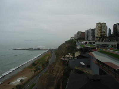
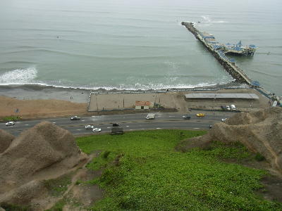
Miraflores Area, Lima City
|
■Water Problem in Peru
|
One of the water problems of Peru is that a river which runs through the
shore desert area where many people live flows to the Pacific Ocean from
the Andes of the 6,000m above sea level in distance of only 100km. In other
words it becomes a fast-flowing through a large level difference in a short
distance, water is not used effectively. The Tone river in Japan runs approximately
100km through the Kanto plains. The altitude of Maebashi city which is
a starting point in Kanto plains is approximately 100m, so we can see that
its steepness. And it is greatly influenced by precipitation change of
the season of the Andes. The summer from November to April has much rain
and water quantity is abundant, however there is little water because no
rain in winter season from June to September. Available water quantity
is limited because there are few storage dams in mountain area and cannot
store water in rainy season.
In summer season, even though water is abundant, a large quantity of rain
which falls in the Andes washes away the land and it becomes a muddy stream.
Furthermore, there are many mines supporting Peruvian economy in mountain
area, mine drainage contains harmful heavy metal and soil begin to flow,
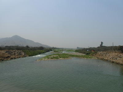
and the river is polluted as to be called black water. Rimac river flowing
through Lima City changes into the river of muddy water, and 8 millions
Lima citizens take this muddy water as drinking water.
|
 |
 |
 |
| Rio Rimac |
Suburbs of CANETE City |
Miraflores Area |
|
Another water problem is caused by the economic development. It is similar
in any countries that economic development in developing country causes
environmental destruction, however there are their own problems in Peru.
Firstly, mine drainage from mining for mineral resources which supports
Peruvian economy is discharged almost untreated. Water in Peru is polluted
because developed countries including Japan obtains mineral resources.
"Lake Titicaca" in the Bolivian border is a lake locates at the
highest place in the world. It is 12 times as large as Lake Biwa in Japan,
and attracts attention as a sightseeing area. However, it is polluted by
wastewater from copper mine whose production is third in the world.
Sewage wastewater, residential wastewater and factory wastewater increases
by population concentration of urban area, and most of them discharged
into the Pacific Ocean without any treatments. There are tentative sewage
treatment plants in big cities such as Lima, most of them are called lagoon
method. In lagoon method, sewage stays in the big reservoir and water is
purified by nature's purification capacity. A big treatment effect is not
expected with this method. In many local cities, even this lagoon treatment
is not carried out, and untreated sewage is discharged into the river,
flows into the Pacific Ocean.
|
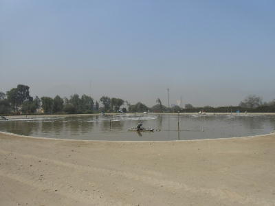
Lagoon Method
Sewage Treatment Plant |
|
In Peru, there are many world heritages and Inca Empire attracts attentions
as global sightseeing spot. However, many people live in poverty, and urban
infrastructure systems such as drinking water purification and wastewater
treatment are not advanced. These base systems is not prepared in a short
time even in Peru where economic development with abundant mineral resources
remarkably advances. Therefore present conditions of water environment
is extremely severe.
|
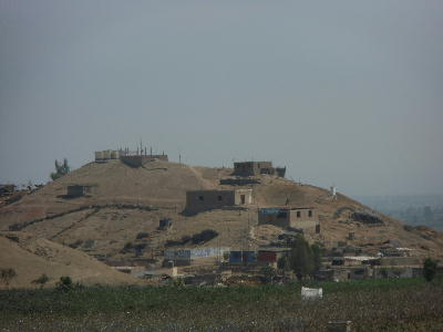
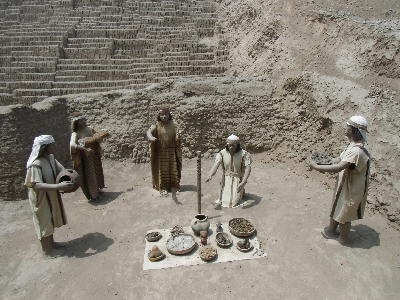 Huaca Pucllana Huaca Pucllana |
|
|